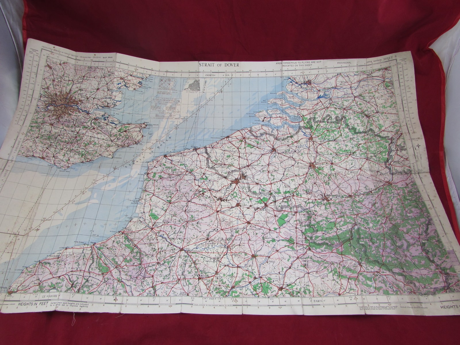
1942 Cloth-Backed Map of the Strait of Dover – WW2 Period
$32.43
$44.75
1942 Cloth-Backed Map of the Strait of Dover – WW2 Period An original 1942 linen-backed map of the Strait of Dover, produced during the Second World War. This map depicts one of the most strategically important waterways of the war, separating England and France, and central to military planning, naval operations, and coastal defence during the conflict. The map is cloth-backed, a feature typical of military and field-use maps of the period, designed to provide durability and ease of handling in operational conditions. Details: Date: 1942 Area: Strait of Dover (English Channel) Type: Cloth-backed map Period: Second World War (1939–1945) Condition: Good overall condition. Shows light age-related wear, including minor creasing and handling marks consistent with use. Cloth backing remains intact, ensuring the map is strong and displayable. Notes: Maps of the Dover Strait from the wartime period are particularly desirable due to their association with coastal defence, cross-channel operations, and the wider context of the European theatre. Ideal For: WW2 collectors and historians Map and cartography collectors Coastal and naval history enthusiasts Display or framing projects A historically significant and visually appealing wartime map from a key strategic location.